Geographic Information Systems Laboratory
Specializing in the Spatial Analysis of Environmental Data
Geographic Information Systems (GIS) is a science that integrates software, hardware, and field data to analyze the natural and built environment across space and time. Existing conditions and changes in conditions can be analyzed using a multivariable approach. Undergraduate students acquire an important job skill by taking the introductory and advanced classes in GIS, remote sensing, and digital mapping.
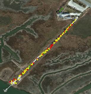
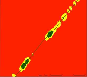
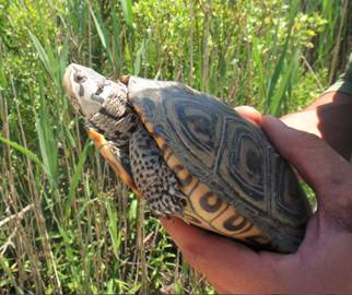
Conservation Biology Project
Spatially Analyzing Successful Diamondback Terrapin Nesting Sites
at the New Jersey Wetlands Institute.
Filed Mapping of Nesting Locations Point Density Anallysis of Nesting Preference
Remote Sensing and Digital Mapping
Remote sensing is a suite of techniques used to determine environmental conditions from a distance without actually touching the object or visiting the site. Digital mapping is the opposite, where you are immersed at the site and directly measuring all environmental conditions of interest.
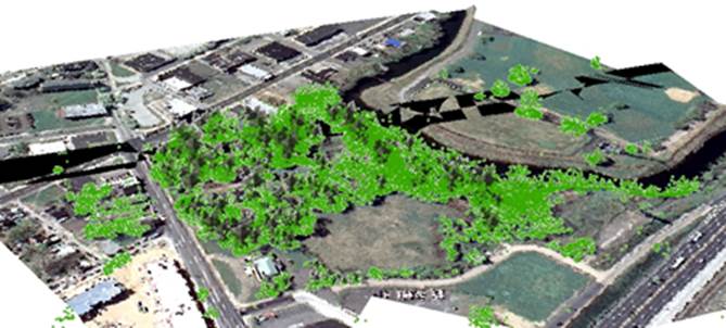
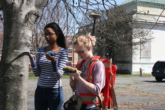
Conservation Biology Project
Digital Mapping of Trees using High Accuracy Global Positioning Systems
for DeShong Park in Chester, PA
Analyzing Remotely Sensed LIDAR Data to support Conservation Biology in
DeShong Park, Chester, PA